


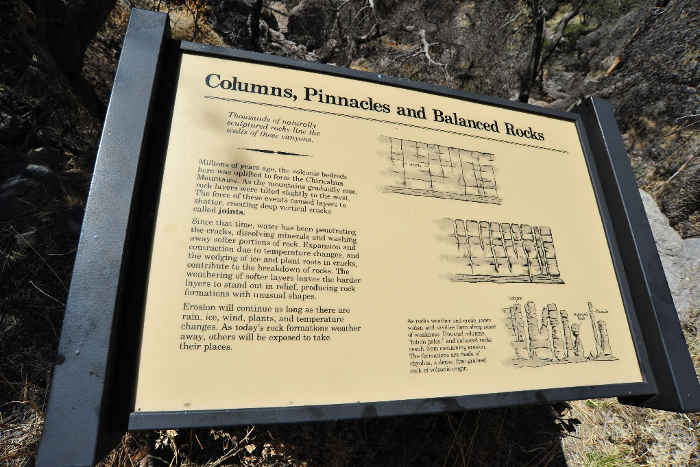


 Twenty-seven million years ago (give or take a day or two...), the Turkey Creek volcano erupted, spewing a column of super-heated particulate thousands of feet into the sky, eventually blanketing more than 1,200 square miles of surrounding countryside with molten particles that formed layers of gray rock known today as rhyolite. Innumerable sequences of cooling and uplifting caused cracks in these igneous formations which were then weathered by milleniums of ice wedging and erosion by wind and water, a process that continues into our current time.
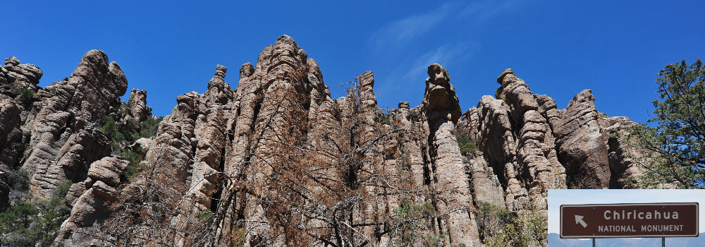
Carved by natural processes into incredible shapes, Chiricahua National Monument's aptly named Wonderland of Rocks towers above surrounding forrests and neighboring grasslands. Pillars of aged volcanic stone stand sentinel over over a vast domain of sycamore, juniper, oak, cypress, pine and fir woodlands, a multitude of high desert cacti and an amazing array of living creatures both large and small.
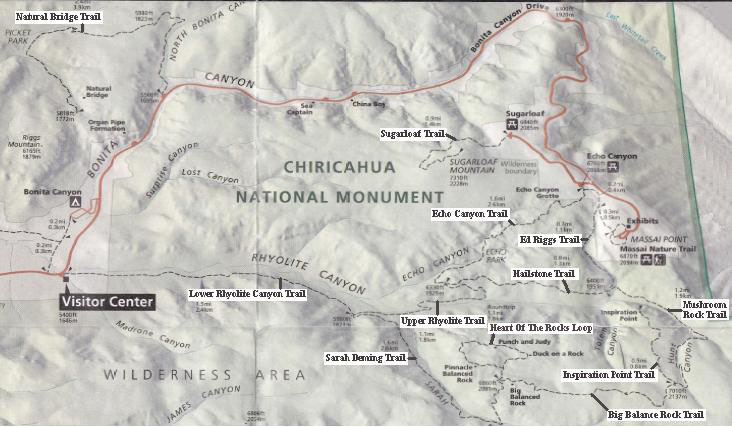
Designated as a national monument in 1924, the 11,985 acre Chiricahua Monument offers hiking, camping, and scenic drives located just an hour drive from Bisbee. (Click map above left for a printable enlargement.) Map is provided by the Cochise County Tourism Council, full version is linked under the maps list at your upper right.
Isolated mountain ranges (such as the Chiricahua Mountain's Wonderland of Rocks) that emerge from seas of grassland thus providing unusual habitats in contrast to surrounding areas are often referred to as Sky Islands, a term popularized by nature writer Weldon Heald in his 1967 book Sky Island. Heald, a resident of southeast Arizona, demonstrated the sky island concept by describing environmental and ecological changes encountered along a thirty-five mile drive from Rodeo, New Mexico, to the Chiricahua Mountains. This concept was earlier recognized by Natt N. Dodge in a 1943 Arizona Highways magazine article when Dodge referred to the Chiricahua Mountains as a "mountain island in a desert sea."
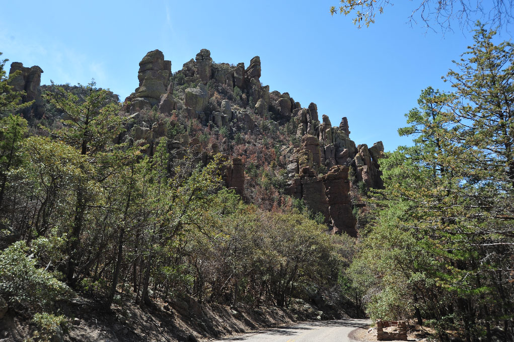
Visitors to the Chiricahua National Monument can avail themselves to a panoply of naturalist attractions during their time in the park. Trails range from a handicapped-accessable path at the crest of Massai Point to day hikes along well-maintained walkways. Campgrounds have spaces for tents and recreational vehicles though a phone call to the park before finalizing plans is suggested to verify availability and any applicable alerts. As can be seen in several of the accompanying images, Wonderland of Rocks stills shows scars resulting from the devastating Horseshoe II forest fire in 2011. Monsoonal moisture has revived some the foliage but many years will pass before nature fully restores the damage. Whether hiking or camping, vigilance is necessary to help prevent another flaming tragedy.
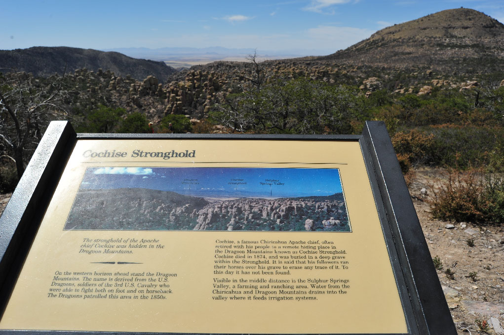 The Chiricahua Mountains were for several centuries a favorite haunt of Native American people, including the fierce Apache tribes, who referred to the rhyolite columns as "Standing Up Rocks." One of the most famous of the Chiricahua leaders, chief Cochise, is buried in a hidden site near Dragoon, visible in the distance from Wonderland of Rocks (image to the immediate left). Our Fort Bowie page has more information on the history of the Apaches who once called this land their home.
The Chiricahua National Monument is a photographer's dreamland. By all means, don't forget to bring your camera...and a cooler with food and bottles of water. The nearest restaurants/convenience stores are about 30 minutes away. Also take in consideration that the park entrance is about 5,000 feet elevation (temperatures are usually quite similar to what you'll be experiencing in Bisbee) but elevation at Massai Point is 6870 so the thermometer will read as much as 8-10 degrees lower at the mountain tops.
Images to the right are linked to enlargements which will appear in a separate frame. They are as follows:
- 1: Road into the park just past Visitors Center
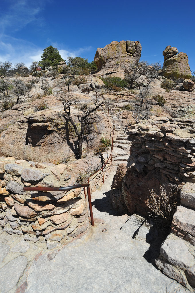
- 2: Trail leading from Massai Nature Trail Outlook
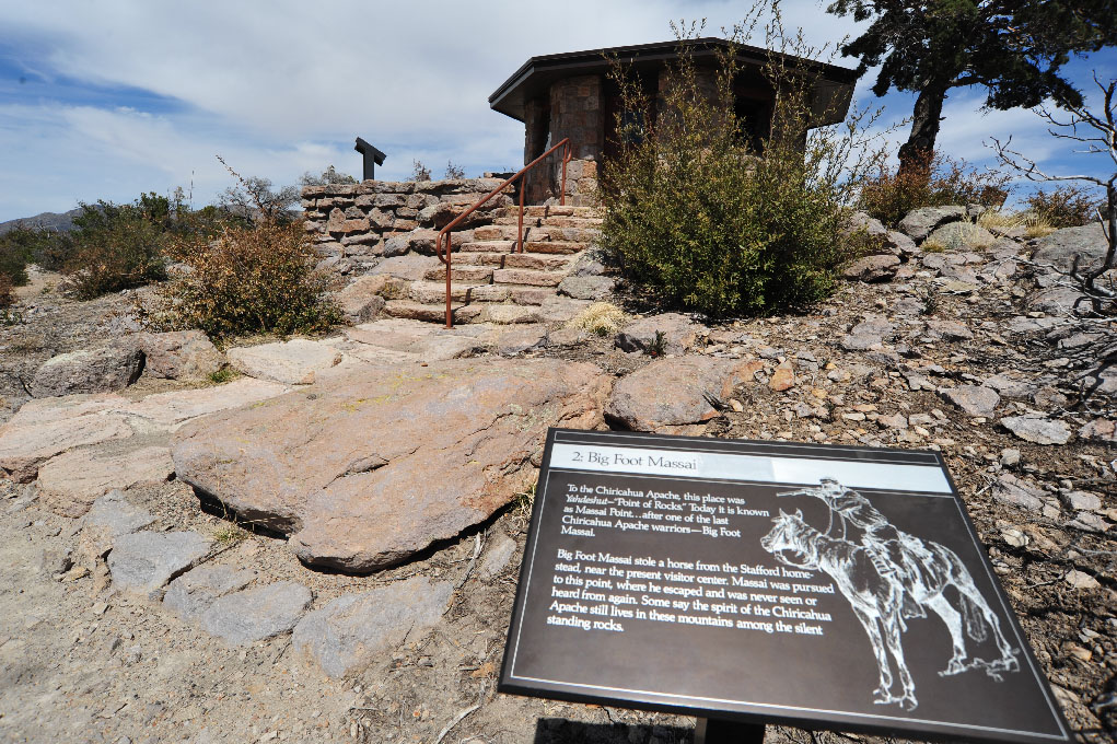
- 3: Geological Information Signage
- 4: Massai Point Enclosed View Area
- 5: Massai Nature Trail Outlook
- 6: Chiricahua Monument Visitors Center
- 7: Map of Chiricahua Monument
A modern visitor center located near the entrance to Chiricahua National Monument has several displays that concern local Native American history in addition to extensive material on the background of Wonderland of Rocks. Several books these subjects are available for purchase at the Visitor Center. Roads into the Chiricahua Monument are paved and well-maintained. Paved parking areas are available for day hikers at both the visitors center and Massai Point. A $5 per person fee is charged for one-day stays (unless visitors have a national park pass). Fees are also assessed for overnight camping. More information on park policies, special alerts is available by visiting the Chiricahua National Monument website or by calling the park at 520-824-3560. Visitor Center operating hours are 8:00 AM until 4:30 PM daily except for Thanksgiving and Christmas Day.
Copyright © bisbeeaz85603.com. All Rights Reserved.