


![]()
 Arizona is rich in history but often its fascinating past has been "touched by modern man," commercialized, painted in garish colors...or destroyed, paved over, turned into a shopping mall or residential development. Some historic buildings and locations have survived mankind's onslaught but are now surrounded by neon signs, fast food restaurants and the roar of traffic. Seldom does one encounter the visceral sensation of being in the presence of history much as it originally existed.
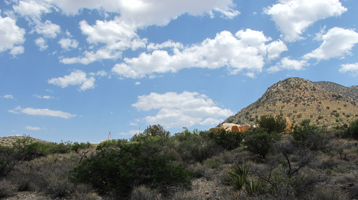
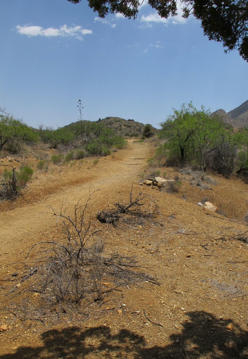
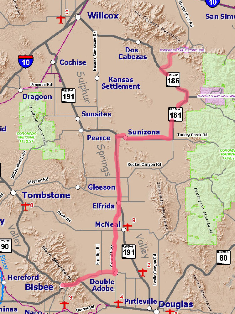
Experiencing this unique ambience is well worth the hour and a half drive from Bisbee northeast through the Sulphur Springs Valley then east along 8 miles of dirt road to a parking area at the trail head where one walks a mile and a half to view the remnants of Fort Bowie. (Click map to left for a printable enlargement. Map courtesy of Cochise County Tourism Council, full version is linked under the maps list in your right column.) There's a park service visitor center located by the remains of the fort; it's open 8:00 AM-4:30 PM daily and has rest room facilities, literature and water available. There are no park fees and no camping area.
Let's learn about the circumstances that caused Fort Bowie to be created a century and a half ago.
1848: The United States and Mexico signed the Treaty of Guadalupe Hildalgo, thus ending the Mexican-American War. A huge block of land (including California, Nevada, Utah, northern 2/3 of Arizona, a piece in southwest Wyoming and most of the western portions of Colorado and New Mexico) was ceded to the US. Five years later, James Gadsden negotiated a payment of 10 million dollars to the Mexican government in return for an additional swath of property. This new parcel of desert included much of the southern portion of what is now Arizona, including Tubac, Tucson and an area newcomers called Apache Pass, where Fort Bowie would eventually be located.
Agreements establishing control of the west were negotiated between diplomats representing the United States and Mexico. No members of the Native American groups living in this vast area were queried about their take on the treaty. Mexican citizens who chose to remain in what was now a US possession were granted citizenship and their property rights were to be respected by the US. Land rights and citizenship weren't extended to members of tribal groups affected by the change of sovereignty, a disparity that inevitably led to clashes and bloodshed.
In 1858, the Butterfield Stage Company built a stage stop at Apache Pass, near an artesian spring. In a part of the world where water was often more valuable than precious metals--gold was worth more money but it didn't do much to slake one's thirst--the springs provided year round supplies of water for horses and people. Apache Springs was critical to both indigenous residents and the newcomers. It became the scene of murders, betrayals, and battles between the Native Americans and the newcomers.
In 1861, a young US Army lieutenant named George Nicholas Bascom confronted the Chiricahua Apache chief Cochise at a meeting near Apache Springs in what became known as the Bascom Affair. Blood flowed freely. Cochise took the lives of several whites; Bascom hanged Cochise's brother and several of his nephews before returning to Fort Buchanan where he needed to attend to more important matters such as the Civil War (he was killed just a year later). The incident between Bascom and Cochise sparked three decades of periodic fighting between Apaches and the whites.
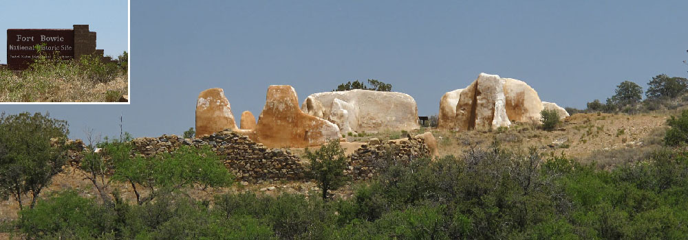
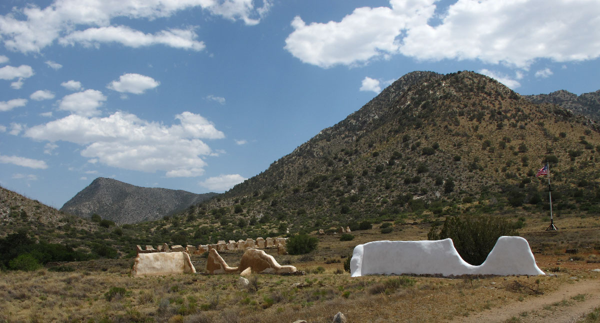
By 1862, the Apaches had been driven away from the springs but they were never far away. An army post was established to protect the precious water and ensure that it was available to stages and wagon trains carrying settlers on their westward journey. Fort Bowie wasn't a desirable assignment but its location made it critical to the settlement of Arizona Territory and to the pacification of the native peoples. Only after the last small band of Chiricahua Apaches still fighting to stay off the reservation laid down their weapons and surrendered to the US Army in 1886 did Fort Bowie become redundant to the army's mission.
The fort was phased out in 1894, its soldiers dispersed to other posts throughout the country. Adandoned, the stone walls of Fort Bowie began to collapse. Wooden buildings were disassembled for the lumber. The stage station was no longer needed, iron rails passed north of the springs through what is now the town of Bowie. Trails once crossed by rickety stages and wagons faded into the foliage. Then, in 1964, Fort Bowie, the Butterfield stage stop, a fort cemetery (buried soldiers had been removed and taken to federal sites; civilian remains are still there), Apache Springs itself and the site of the "Bascom Affair" were designated a national historic site. By the 1970s, a visitor center was established, some of the remaining walls of the fort were treated with stucco to prevent further decay, and informational signs were erected along the trails.
 One can still sense history in this land. Cochise walked these very trails, drank water from the springs, fought against the newcomers. The Apache shaman Geronimo and Naiche (sometimes referred to as Nachez), Cochise's son and hereditary chief of the Chriicahua tribe, were held at Fort Bowie for a few days after surrendering to General Nelson Miles in 1886. There are still no fast food outlets, no tramcars to carry loads of people along the pathways. The wind soughs through scrub oak and mesquite, feet crunch along the trail much as they would have for hundreds of years before "civilization" arrived.
Interested in knowing more about Fort Bowie? Click here for a .pdf pamphlet with background on the fort (including photos of Bowie and its residents back in the 1800s). Click here to visit the Fort Bowie National Historic Site website.
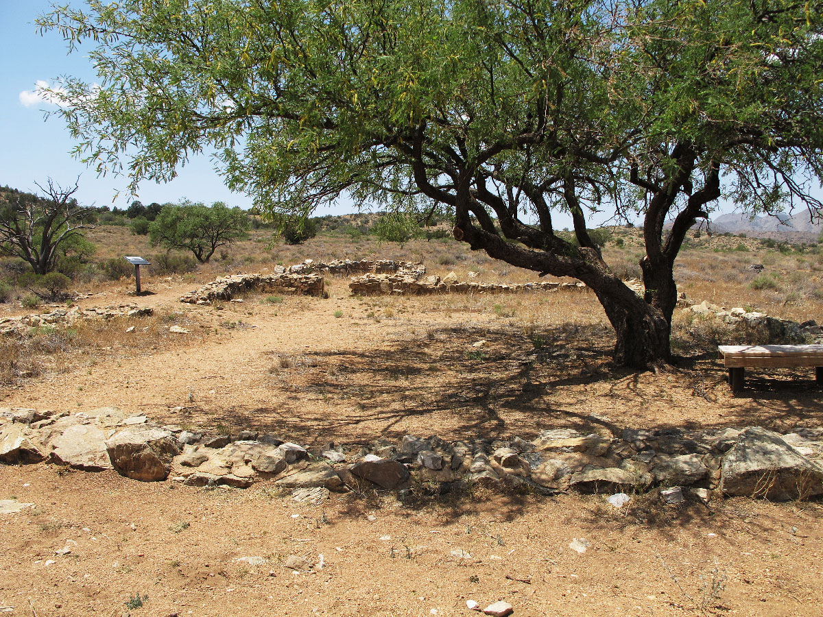
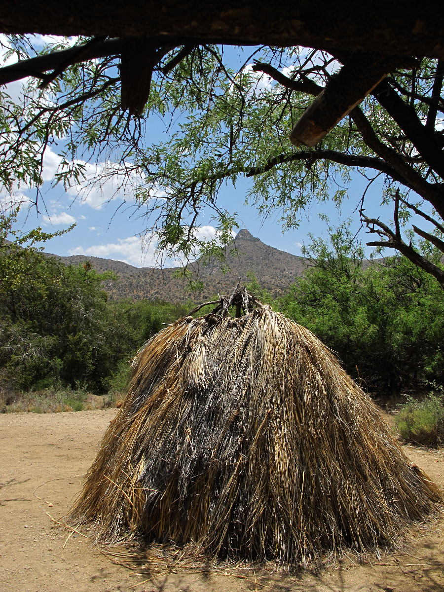
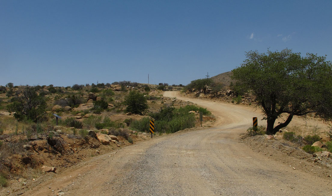
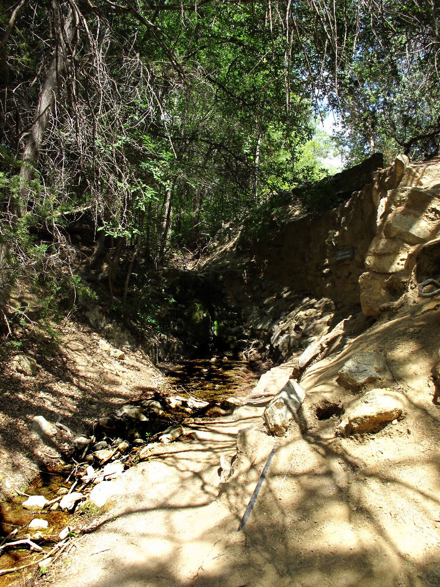
Photos (from top to bottom): First Fort Bowie, from trail; the trail not far from the trail head; remains of second Fort Bowie; remains of Butterfield stage station; Apache style wickiup, road to Fort Bowie (from AZ 185), Apache Springs head water (Click images to bring up enlargements in a separate frame.)
Note: The dirt road through Apache Pass is well-maintained and is no problem for the family sedan but...it is dirty, dusty and somewhat rough. The trail from the parking area in to Fort Bowie is not challenging for most people. Hiking boots or shoes are recommended. The trail is, particularly during the summer, hot and dry. Total distance in and out is 3 miles. Benches are placed frequently along the trail. Water is available at the visitor center located beside the ruins of the fort but it's always a good idea to carry extra fluids. Rest rooms are located at the visitor center and the parking area; no fees to enter the site, no camping area.
Copyright © bisbeeaz85603.com. All Rights Reserved.